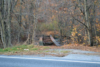
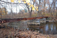
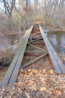
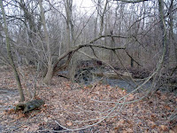
I have discovered on Google Maps three locations (to the east of Chambersburg, PA) of this old rail line. Two of them I have found in person. The third is buried on private property. Winter is the best time to locate these bridges as they are not full bridges, but fragments of steel I-beams, girders, or stone.
BRIDGE A
The first bridge is more like decking with abutments and piers can be seen to the north of Brindle Road.


Bridge remnants near Edgewood Court. Note: this road is a dead-end even though it looks complete. To locate the bridge come at it from the west.


BRIDGE C
The third bridge is off of Woodstock Road. It is within a thick forest of private land. I have not located it in person, but I believe it to be where the waterway makes a quick hook east and then south again.


Hate to say this as a historical correction. That bridge-A at Brindle Rd actually was along the Scotland and Mont Alto RR (M.A.RR) ─ a.k.a. the Mont Alto RR ─ which in 1872 spanned the distance from the Cumberland Valley RR (CVRR) near Scotland, Pa. to Mont Alto, Pa. in Southern Franklin Cnty. The new Mont Alto line connected with the CVRR (Mont Alto Jct.) at a point few miles northeast of present-day Chambersburg, branching parallel to the CVRR and abruptly turning south through the unincorporated communities of Burgner, Brookside, and Woodstock. The line continued southward to Font Hill, Fayetteville, and Pond Bank, before terminating in Mont Alto, at the Mont Alto Iron Works. The Mont Alto RR was extended in stages from Mont Alto farther south to Kuepper, Quincy, Nunnery, and Waynesboro, Pa. At this point in time the name of the connection with the CVRR was referred to as the Waynesboro Jct., and the M.A.RR line from the CVRR to Waynesboro was referred to as the Waynesboro Branch (as opposed to the branch and wye in Mont Alto to the iron works).
ReplyDeleteIn 1897 the M.A.RR was leased to the CVRR, which undertook all operations to sustain the Mont Alto RR. Around 1901 the M.A.RR was sold, and the M.A.RR name also was reorganized as the Cumberland Valley and Waynesboro RR. Around 1902 the name Mont Alto Jct on the CVRR was changed to Waynesboro Jct. I do not know exactly when the Waynesboro Branch officially became incorporated into the CVRR system, although by 1919 the Pennsylvania RR (PRR) had purchased the entire CVRR, the latter having been referred to as the Cumberland Valley Division of the PRR.
The C & G RR was founded in 1890 and its western terminus (C & G Jct.) was at Conococheague Island, about 1 mile south of the still-existing deck girder bridge (Bridge A), and less than a half mile south of Woodstock. The eastern terminus of the C & G was at Wolf Hill, north of Caledonia in extreme Eastern Franklin Cnty. Conococheague Island is that huge wooded area shown in aerials of bridges B and C, encompassed by the small streams that form Conococheague Creek. C & G trains would interchange at C & G Jct. with the Mont Alto RR. While this bridge (Bridge A) indeed was traversed by C & G trains given trackage rights onto the M.A.RR and on to the CVRR to Chambersburg (a namesake borough of the C & G). Because the C & G followed the south side of the Conococheague Creek all the way to Caledonia (following closely north of what is now Highway US-30), Bridge B as well as Bridge C also likely would be property of the former M.A.RR, the former trackage of which was still in use into 1972 under the Penn Central. Along that same reasoning therefore, those crossings of the Conococheague Creek north of Fayetteville (all three bridges) would have been only for the Mont Alto RR.
The C & G RR had been completely dismantled around 1900.