Sunday, June 26, 2016

Commute via Yellow Breeches Creek

"Commuters Guide Volume 2"

<<SARCASM DISCLOSURE...However, all the paddling information is true.>>


Continuing the series of how folks can consider kayaking as a green alternative for commuting to work. Today, we will look at using the Yellow Breeches Creek which conveniently serves anyone from Mount Holly Springs area to Goldsboro.

Travel from Mount Holly Springs area to Goldsboro, PA


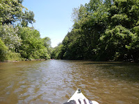
Kayaking the yellow breeches and lush banks of foliage
Named “Pennsylvania Scenic River” in 1992, the Yellow Breeches Creek is even more popular today as many fishermen and paddlers seek out the pastoral views to escape the heat and everyday stressors.
The story behind the naming of this creek dates back to the Revolutionary War. British soldiers either clad in their white breeches crossed the creek, or washed their breeches in the creek, and the knickers turned—you guessed it—yellow.
Originating on South Mountain, in Michaux Forest, Cumberland County, near Walnut Bottom, the "Breeches" flows west to east over a limestone valley. Many springs along the way feed this cool-water creek making it ideal conditions for trout.

Map of the yellow breeches to susquehanna river
Yellow Breeches to Susquehanna River
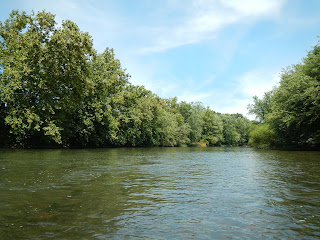
Kayaking the yellow breeches and lush banks of foliage

Unlike the Conodoguinet (see Commuters Guide Volume 1), this creek wanders through areas not as developed until you approach the Green Lane Farms and Allendale communities. Up until then, the banks are not adorned with dense housing, but rather limestone hills, forests and farmland.


Water Levels

Kayaking the yellow breeches by a limestone rock hill near Green Lane FarmsFor the commuter options, we will be starting at South Middleton Township Park between Mt. Holly Springs and Boiling Springs. The Camp Hill gauge should read over 1.4’ to paddle here and down to Messiah College comfortably and 1.3’ to paddle further south. Any lower and there are areas you may scrape or have to walk, boo. On the other extreme, again based on the Camp Hill gauge, action stage is 6’ and flood stage is 7’. My advice is if the gauge is over 3.5' and 650 cfs you might want to reconsider paddling to work unless you and your coworkers don’t mind the smell of feces.

Wildlife You Might See
Great blue heron on branch about to take flight


  • Brown Trout
  • Rainbow Trout
  • Brook Trout
  • Great Blue Herons
  • Common Merganser Ducks
  • Mallard Ducks
  • Snapping Turtles
  • Box Turtles
    Common Merganser Duck mother with multiple babies
    Common Merganser Ducks

The Route

Access points, dams and other obstacles noted on 41 miles route
41 miles of paddling on the Yellow Breeches and Susquehanna River
Click to access sheet in a larger view

Some things to note about the route:

  • Allenberry Playhouse is for sale, pending an auction in July 2016. This shouldn’t impact your paddle, but the name of the establishment may change.
  • As of Spring 2016, construction on the Locust Road Bridge has washed out the area above the bridge—think swamp—so it may not be paddle-able.
  • As of June 2016, construction at Messiah College has forced the student commuters to park at Starry Fields parking lot and as a result the public may be forced to park elsewhere.
  • As of September 2015, Yellow Breeches Park has been closed until further notice.

Commute Times


These times are based on proper water conditions, great weather, no headwind and you are paddling the whole time.

  • Coming from the east of Mount Holly Springs (South Middleton Township Park) to work at Three Mile Island near Goldsboro will take you almost 13 hours as it is over 41 miles. Ignore the fact that you have to cross five dams and multiple other obstacles and focus on all the money you are saving by not having to take the Pennsylvania Turnpike!
  • Perhaps you live in Boiling Springs and work at Williams Grove Speedway in Mechanicsburg. The nice thing is you are paddling right up to work after a 3-hour paddle.
  • Maybe you live in Lisburn (Lower Allen Park) and work at the Rossmoyne Business Center in Mechanicsburg. The paddle would only take you to two hours. Ignore the fact that it is only an eight-minute drive—12-minutes in traffic—and your suit will need ironed when you arrive.
  • If you live in New Cumberland and work at Harrisburg International Airport in Middletown, you are looking at a 2:15 hour commute, mostly down the Susquehanna. All the while soaking in the historic sites of the former glorious steel industry on the bank of Steelton.


Final Thought

If you work at Capitol City Mall or the Camp Hill Prison and happen to live in the area of Slate Hill Road, Valley Road or Limekiln Road, I can offer an ideal commute. This one traverses through idyllic scenery and allows one to enjoy themselves versus the road rage and stop-and-go traffic. Put-in at Slate Hill Road and take-out at Spangler’s Mill. Years ago, I had a Pitbull mix that loved to swim/run along this stretch so I named it after her, Zoe’s Run. Take in the pastoral scenery, deep shaded pools flanked by dense trees as there is barely any development and enjoy this 30-minute commute as Zoe once did.


Pitbull mix in the Breeches by Etters Bridge
Zoe in the Breeches by Etters Bridge


Shout out to Marty R. for her input on the western part of the Breeches.

Resources


Sunday, June 19, 2016

Commute via Conodoguinet Creek

"Commuters Guide Volume 1"

<<SARCASM DISCLOSURE...However, all the paddling information is true.>>


Many folks consider green alternatives for commuting to work. Walking, bicycling, sharing rides and taking public transportation are the usual considerations. By why not kayak? Let's explore the logistics and feasibility involved with paddling to work. Today we will look at using the Conodoguinet Creek which conveniently serves anyone from Carlisle to Camp Hill passage east to Harrisburg.


Bird seen on paddle trip of Conodoguinet Creek
Travel from Carlisle area to Harrisburg area in Pennsylvania
Instead of I-81 with the dreaded truck traffic, consider paddling from Carlisle to Harrisburg (or any points in between) via the "Conodoguinet Creek Expressway."

If you aren't familiar with the creek, the name sounds similar to "Can I go in it?" It is pronounced CON-oh-do-gwin-it. This Indian word means "a long way with many bends" and this creek lives up to its name. So maybe this is not an expressway, but rather an idyllic commute.
Map of entire creek with dam pointed out

The "Connie" originates in Horse Valley close to Letterkenney Reservoir. The creek flows west to east. It rambles down the Great Valley north of Roxbury through a handful of gaps crosscutting the divide between the Appalachian Mountain and Great Valley sections and drops a total of 1,700 feet at the confluence with the Susquehanna River.


View of Conodoguinet Creek
For this discussion, I have divided the creek into two parts due to a dam between Rt. 74 and Rt. 34. We will be looking at just the eastern half of the creek--downstream from the Carlisle Raw Water Intake Dam. Unfortunately most of the steep gradient occurs before this dam. But, on the bright side, the eastern part of the creek widens up, so strainers are no longer an issue. By Mechanicsburg, the creek's shape is serpentine and as wide as many rivers.


View of creek and old bridge pier near Willow Mill Park
The logistics involved are based on a water level of at least 1.7' using USGS Hogestown gauge. Any lower and there are areas you may scrape or have to walk. Fun fact: It takes 20 hours to flow from the headwaters to the Hogestown gauge. So if a downpour occurred at noon on Tuesday near Roxbury, the water wouldn't hit Mechanicsburg until 8AM the next morning. Another fun fact is that 8' is the flood stage. Really, if the gauge is over 4' you might want to consider working from home rather than paddling to work unless you are fully insured and an expert paddler.

Wildlife You Might See
I have seen at some point or multiple times the following:
  • American Bald Eagle
  • Smallmouth Bass
  • Tiger Muskellunge
  • Catfish
  • Rock Bass
  • Golden Rainbow Trout
  • Egrets
  • Great Blue Heron
  • Kingfisher
  • Cedar Waxwing
  • Woodpecker
  • Box Turtles
The Route
Map of Conodoguinet Creek - Carlisle to Harrisburg
Over 35 miles of passage on the Conodoguinet from Creekview Park in Carlisle to Harrisburg
Kayak Trip Options listed by put-in and take-out with miles
Trip Options

Commute Times
So here's where it gets interesting. Keep in mind we have optimum water conditions, great weather, no headwind and you are paddling at a comfortable speed the whole time (we don't want you all sweaty for work).
  • Carlisle (Creekview Park) to Midtown Harrisburg (Maclay Street) will take 12 hours--yes, one way. It is over 37 miles. In contrast, you could drive on I-81 and be there in 30 minutes.
  • Maybe you live near Willow Mill Park and work at Wegman's. The paddle would only take you two hours--much more reasonable (until you have to go home).
  • Perhaps you live off Orrs Bridge Road where the Connodoguinet Youth Park is and work at Holy Spirit Hospital. Let's hope you aren't a doctor on-call because that paddle would take you a little over 2 hours to arrive at Siebert Park (and then you get to climb up that dang hill to Center Street).
  • If you live in Camp Hill near Siebert Park and work in downtown Harrisburg, you are looking at close to an hour-and-a-half commute. That's not so bad until someone steals your ride.
Final Thought
I think the most pleasant commute would be from Carlisle to Silver Springs Commons. It is a scenic trip. You miss the Middlesex traffic, the fast food temptations and it would take a measly four hours. Who wouldn't want to start paddling at 4AM to make it to work by 8AM?


Resources
Map
Gauge data

Wednesday, June 15, 2016

Why I live in the Harrisburg, PA area


Adventures on the Water

Often people ask why I live in the Harrisburg, PA area. 
This map should explain it. 

These are waterways I kayak often.

Conodoguinet Creek

Yellow Breeches Creek
Swatara Creek
Sherman Creek
Juniata River
Susquehanna River


These moving waterways are all within a 45 minutes drive of where I live in the suburbs of Harrisburg on the west shore. I have access to over 150 miles of paddling fun that can be broken into various sections. 

Who needs to go miles away for some relaxation? I can get it within a 10 to 45 minute drive. If I add another 30 minutes I have access to another handful of waterways: Monocacy River, Conococheague Creek, West Branch Conococheague Creek, Antietam Creek, Schyulkill River and more sections of the Juniata and Susquehanna Rivers.

Get out and enjoy nature!

If you don't have your own gear I recommend these outfitters: 
Susquehanna Outfitters in Harrisburg, PA
www.susquehannaoutfitters.com/
717-503-0066
Blue Mountain Outfitters in Marysville, PA
www.bluemountainoutfitters.net/
717-957-2413

Come back for future posts on water levels, shuttling tips and gear for sale.

Wednesday, June 8, 2016

Wondering About Vehicle Controls


This blog is more about "wonderings" than wanderings. This article has a special purpose here because it relates to how we wander in our vehicles--how we interface with our automobiles while we explore.

The Issue
In the past, the value of an automobile was getting from point A to point B. Gradually, a few additional needs came into play: reliability, comfort and safety. Today, while these are all still considered as "user criteria" we now see even more features packed into these objects to appeal to entertainment needs and, dare I say, even swagger needs--where else does interior LED mood lighting get categorized?!

The interface of a modern automobile is cluttered with buttons, knobs, dials, switches, touchscreens, steering wheel controls and voice command capabilities. Take a look at a 2016 Land Rover to one from 50 years ago. Before GPS, before computers were the size of pint of beer and what you see is a pretty basic interface.

1966 Land Rover Series IIA...simple

2016 Land Rover Range Rover Evoque...so many controls where do I begin?

Manufacturers are jam-packing features into cars with disregard for standards. It's all about "car company A" versus "car company B" at the expense of the user's learning curve.

I'm not trying to limit invention or improvements. I'm just asking for a framework--a set of rules--that dictate certain functions. Even the most advanced gadget geek will admit to craving regular ol' buttons. It allows us to drive safely while feeling our way around to turn music up, turn the heat down, turn the wipers on--all without taking our eyes off the road. It's common sense.

Maybe I'm being a cynic and perhaps standardization is happening, but if it is, the outcomes are not palatable. Maybe we can blame patents and their greedy holders. That's a another blog for another time, but regardless patents are the scapegoat of the digital age.

The Solution
Standards. I'm all for allowing manufacturers to innovate but they need to commit to a set of standards just like they did with the position of pedals and the steering wheel in the early 20th century. I will close this blog with a few standards I think should be used when designing controls so vehicles are more intuitive:
  • Recognizable standard icons
  • No knob as the control for the computer screen (Mercedes this is especially directed to you and you aversion of fingerprints on the monitor)
    2016 Mercedes GLC knob control--a neat idea for the OCD, a bad idea for usability 
  • Minimum touchscreen size of 7" (any smaller and it's just not accessible for older eyes)
  • QWERTY keyboard
  • Predictive text for data entry
  • Acceptable response times...like less than half a second. I'm trying to drive here!
  • No rotating menus. Use physical buttons if all the information can't fit on one screen. No one wants to wait while the information choreographs itself.
  • Multiple ways to access routine functions so the touchscreen can be bypassed. Alternative options for common functionality include steering wheel controls, large dials/buttons and voice-command. Which leads me to...
  • Full voice control...that actually works!
  • 2013 Ford Fusion volume dial--easy to use and stylish
  • Separate audio volume dial--it needs to be separate and larger so I can feel for it. Ford Fusion gets points for this.
Okay now that we're done wondering, time to go wandering.